Drones represent an exciting development in aviation technology and offer new opportunities for emergency services, businesses and individuals across the globe.
However, if not flown safely they can pose a risk to other airspace users, people on the ground and the operator, which is why we want to ensure the world’s busy skies are safe and accessible for everyone.
"The launch of the GoDrone mobile and web apps is the first step in enabling LVNL to build the Netherlands the infrastructure it needs to open Dutch airspace for special flight operations, to commercial drone use and ultimately BVLOS flight."
Michiel van Dorst, CEO of LVNL
Flight Planning Tools
Our range of flight planning tools, offered both independently and as part of our wider work with ANSPs and National Aviation Authorities, make operating a drone safely as easy as possible. We encourage drone users to download the most appropriate app to their geography to gain an understanding of airspace regulations and to register flights. Happy (safe) flying!
Drone Assist
Region: Worldwide
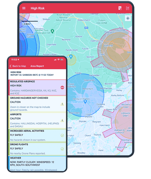
Drone Assist, by Altitude Angel, is a leading worldwide drone safety app, and the #1 app for drone planning in the UK. It provides an interactive map of the sky and is used by general aviation, balloon pilots, other airspace users and of course, drone pilots! It's tailored specifically for the UK audience. It allows you to see areas to avoid or in which extreme caution should be exercised, as well as ground hazards which may pose safety, security or privacy risks when flying your drone.
It also contains a ‘Fly Now’ feature which enables you to share your drone flight location with other app users and the wider drone community, allowing you to avoid other airspace traffic so you can have a safe and enjoyable flight.
The free app is available on the Apple Store and Google Play store.

GoDrone
Region: Netherlands | Created for LVNL
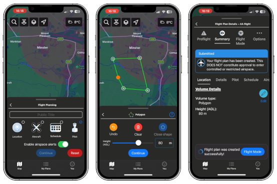
Relaunched in 2024 with enhanced user experience and industry-ready flight planning tool set. GoDrone is the flight planning app for drone pilots in the Netherlands. The most recent update includes accepted flight status’, area reports and an improved user experience.
The free app is available in the Apple Store and Google Play store.

Ninox Drone
Region: Norway | Created for: Avinor
The Ninox Drone app launched a new era in Norway’s aviation history built around Altitude Angel's Unified Traffic Management (UTM) platform.
Through the GuardianUTM Operator Portal, drone pilots can:
- Register a user account.
- Manage organisations, aircraft and Drone Operator fleets.
- Submit and obtain digital pre-flight clearance to operate in controlled airspace to multiple airports across Norway.
- Submit and obtain digital take-off clearance at those same facilities.
- Receive dynamic, in-flight instructions from Air Traffic Control.
- Declare an emergency status (i.e. loss of control) to Air Traffic Control.
By unlocking the incredible potential of drones and UAM to transform lives and revolutionise businesses, safely and securely, Avinor and Altitude Angel via Ninox are leading the way in deploying GuardianUTM to serve – and strengthen – the emerging drone and UAM industries.
The free app is available in the Apple Store and Google Play store.

Coverdrone FlySafe
Region: UK | Designed for Coverdrone
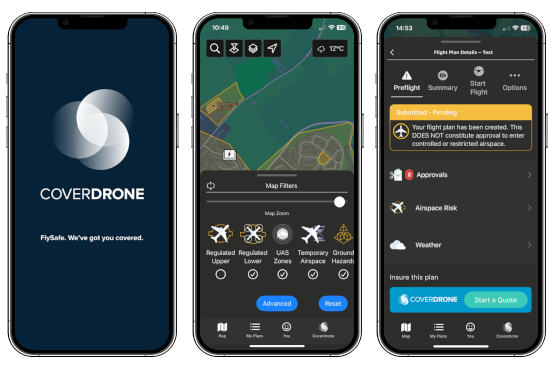
Coverdrone FlySafe is a completely free app designed to help customers with a Coverdrone insurance policy to quickly plan and conduct their drone flights safely and with ease.
The companion app (available for iPhone, iPad and Android devices) delivers rich and accurate safety data ranging from airspace maps, dynamic restrictions, environmental conditions, privacy and safety hazards and even the location of much of the low-flying manned aviation traffic, straight to the palm of your hand.
The Coverdrone FlySafe app, powered by Altitude Angel, is completely free of charge for ALL existing and new Coverdrone clients and provides some exciting features unavailable in other apps!
Price: Free to Coverdrone customers
Available in the App Store and Google Play Store.


