Our solutions are built to safely integrate drones into airspace alongside other air traffic and systems, while being future-proof to adapt to the evolving industry.
- All
- Mobile Applications
- Desktop Applications
Mobile flight planning and approvals.
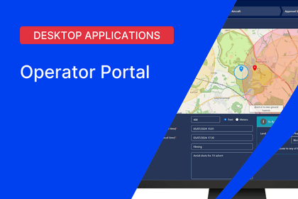
Desktop flight planning and authorisation tool.
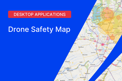
Web-based airspace information map.
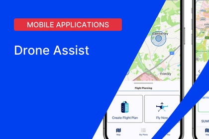
Drone Assist
With international coverage and the #1 drone flight planning and approval app for drone operators in the UK. Plan and submit your drone operations in the palm of your hand, gain zone approvals, and start the flight plan when you’re ready to fly. Whether you want to fly immediately or schedule future flights, the app offers a range of in-app tools to simplify and enable safe drone operations.
Benefit from four intuitive drawing tools, various map types, and the convenience of adding multiple aircraft. Stay informed with access to weather reports and leverage advanced airspace filters, including UAS zones and ground hazards.
Drone Assist works seamlessly with Operator Portal, allowing operations to be planned on a computer in advance - both using a single sign-on.


Operator Portal
Altitude Angel’s desktop flight planning tool, tailored for pre-planning drone operations and offering a consolidated view of all flight plans and authorisations making it a useful tool for individual operators and fleet administrators alike. The portal grants seamless access to crucial airspace and land access data, simplifying flight plan submissions. Enhance your experience further by pairing Operator Portal with Drone Assist, a valuable on location companion.


Drone Safety Map
Used by thousands each year, the web-based Drone Safety Map provides educators, professional and recreational drone operators with access to detailed airspace and ground hazard information across 155 countries. Providing real-time weather updates and aeronautical information, Drone Safety Map is a leading choice for emergency services, drone operators, and aviators, delivering the most reliable planning data globally.

